
No advertisements ~ No data sharing & monetization ~ No analytics ~ No third party libraries
AlpineQuest is the complete solution for all outdoor activities and sports, including hiking, running, trailing, hunting, sailing, geocaching, off-road navigation and much more.
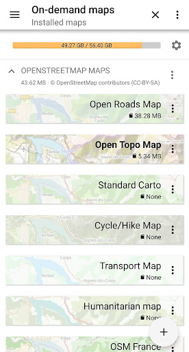
You can access and store locally a large range of on-line topographic maps, which will remain available even while being out of cell coverage. AlpineQuest also supports many on-board file-based raster map formats.
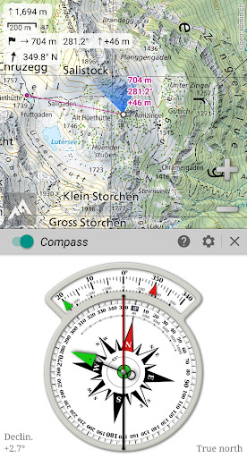
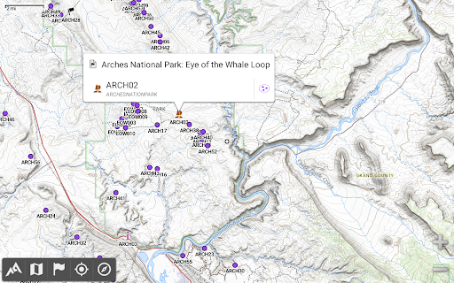
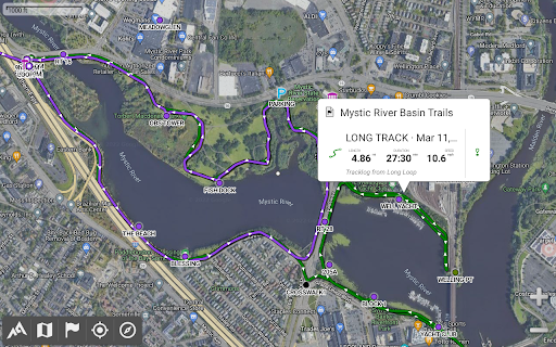
By using the GPS and the magnetic sensor of your device (with compass display), getting lost is part of the past: you are localized in real-time on the map, which can also be oriented to match where you are looking at.
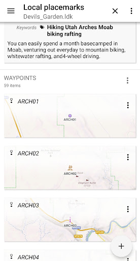
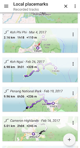
Save and retrieve unlimited placemarks, share them with your friends. Track your path, get advanced statistics and interactive graphics. You won’t have anymore questions about what you can accomplish.
By staying fully operational out of cell coverage (as often in mountain or abroad), AlpineQuest assists you in all your desires of deep wilderness exploring…
Don’t hesitate, use this Lite version right now for free!
PLEASE report suggestions and issues on our dedicated forum https://www.alpinequest.net/forum (no registration needed, all questions answered) and not in comments.
Key features are
(for full version):
★★ Maps ★★
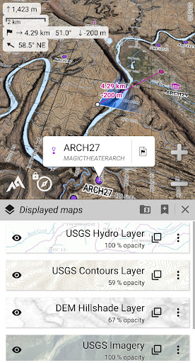
• Built-in online maps (with automatic local storage; road, topo and satellite maps included) and online layers (road names, hillshade, contours);
• Get more online maps and layers in one click from the included community maps list (all major worldwide maps and many local topo maps);
• Complete area storage of online maps for off-line use;
• On-board offline maps support (raster) including KMZ Overlays, OziExplorer OZFx2, OZFx3 (partly) and calibrated images, GeoTiff, GeoPackage GeoPkg, MbTile, SqliteDB and TMS zipped tiles (visit our website to get MOBAC, the free map creator);
• QuickChart Memory Map support (.qct maps only, .qc3 maps not compatible);
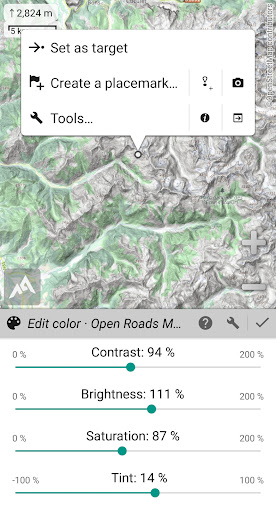
• Built-in image calibration tool to use any scan or picture as a map;
• Digital elevation model on-board storage (1-arcsec SRTM DEM) and support for HGT elevation files (both 1-arcsec and 3-arcsec resolutions) allowing display of terrain, hillshade and steep slopes;
• Polar maps (Arctic and Antarctic) support;
• Multiple maps in layers display, with per-map opacity/contrast/color/tint/blending control.
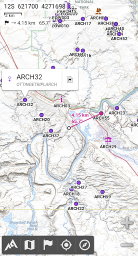
★★ Placemarks ★★
• Create, display, save, restore unlimited number of items (waypoints, routes, areas and tracks);
• Import/export GPX files, Google Earth KML/KMZ files and CSV/TSV files;
• Import ShapeFile SHP/PRJ/DBF, OziExplorer WPT/PLT, GeoJSON, IGC tracks, Geocaching LOC waypoints and export AutoCAD DXF files;
• Save and share online locations with other users using Community Placemarks;
• Details, advanced statistics and interactive graphics on various items;
• Time Controller to replay time-tagged tracks.
★★ GNSS Position / Orientation ★★
• On-map geolocation using device GNSS receivers (GPS/Glonass/Galileo/…) or Network;
• Map orientation, compass and target finder;
• Built-in GNSS/Barometric track recorder (long tracking capable, running in a separate and light process) with battery level and network strength recording;
• Proximity alerts and leave path alerts;
• Barometer support (compatible devices).
★★ And more ★★
• Metric, imperial, nautical and hybrid distance units;
• Latitude/Longitude and grid coordinate formats (WGS, UTM, MGRS, USNG, OSGB, SK42, Lambert, QTH, …) with on-map grids display;
• Ability to import hundreds of coordinate formats from https://www.spatialreference.org;
• …
2.3.7b
• Added duration estimation of drawn paths and routes based on the selected activity;
2.3.7a
• Added ability to set custom items in the center point popup menu;
• Added new “Quick-routing” (quick auto-routing) that skip the creation dialog;
• Added new recorded tracks graphics by months (if only one year is selected) and by activities;
• When using the BRouter offline auto-routing service, a real-time preview of the computed route is displayed as the map is moved;
• And more.


9Apps 4.9


