
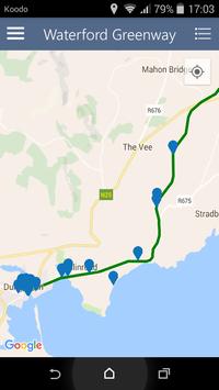
The Waterford Greenway is a multi-purpose trail (known as a "greenway") in the southeast of Ireland. It runs from Waterford City to Dungarvan along the route of a disused railway, completely separate from road traffic. The total distance is 45km.
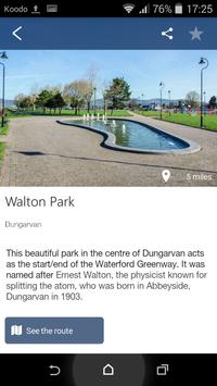
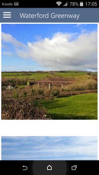
The greenway is renowned for its spectacular route. It starts off running alongside the River Suir and a heritage railway, then through open countryside, across some iconic viaducts and through a tunnel before arriving at the top of a hill overlooking the Atlantic Ocean. From there, it winds its way into the centre of Dungarvan.
The Waterford Greenway is designed for cycling, walking, running, roller-blading etc.
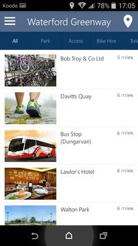
Our app uses geolocation to show you nearby attractions, places to eat, drink, sleep, transport connections, car parks, access points, bike hire shops, general shops and even toilets. This makes it the must-have guide for your Waterford Greenway visit.
The app also has a feedback form where we look forward to hearing from you.
Map has been updated
New businesses and attractions have been added
New section called "Services"
Coordinates added to access points
FAQ updated to reflect the greenway being fully open
The "See" category has been split into "See along the way" and "See nearby"


9Apps 4.9


