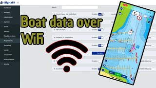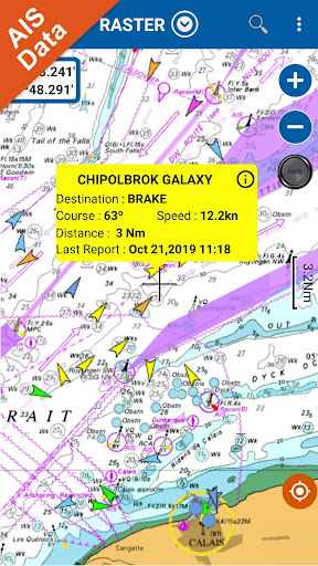
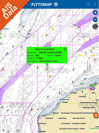
Live AIS now available
Real time map view of your boat and boats near you, worldwide.
No AIS receiver required, just your mobile!
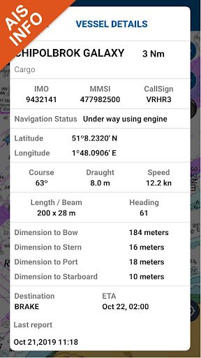
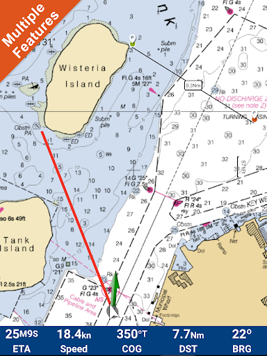
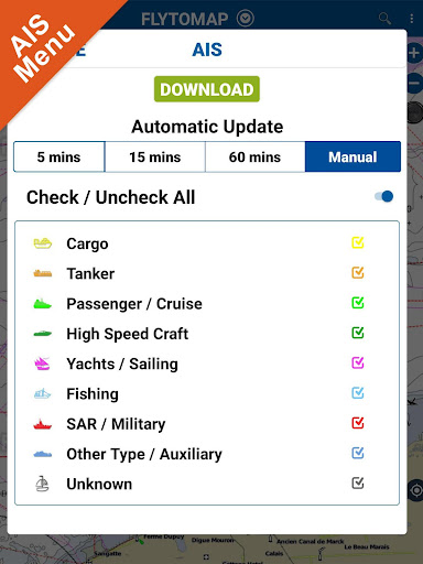
Various icons depict different vessel categories.
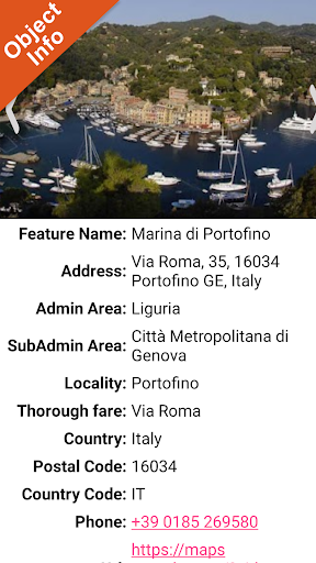
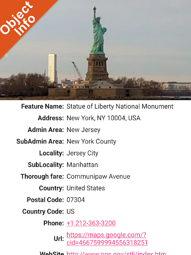
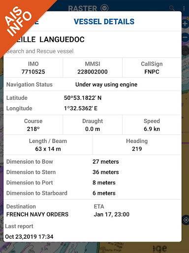
Select any target to see vessel details such as name, MMSI, IMO, call sign, status, speed, heading, coordinates, distance from your GPS location, and more.
Flytomap offers within this app a subscription for a professional GPS chart plotter for only 4.99 USD.
At a glance
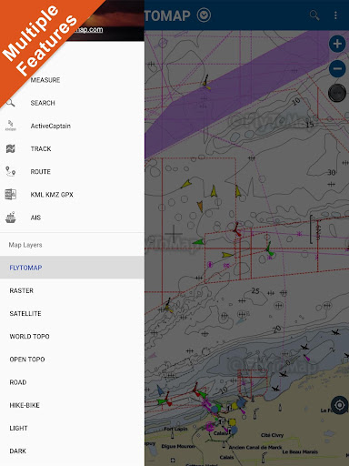
Worldwide Marine and Outdoor Maps available when connected, thanks to viewer.flytomap.com
Worldwide Satellite images overlay on charts
Worldwide Terrain features overlay on charts, thanks to Open Street Map, Open Cycle Map, Earth,topo maps by ESRI
NOAA raster charts seamless with continuous updates from the official Government server
ActiveCaptain - Worldwide boaters community * 200.000 Captains
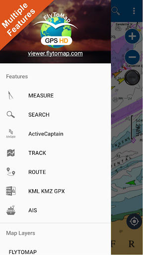
Use to Explore:
√ The maps are downloaded to the device itself, it works in OFFLINE mode. No need of Internet connection.
√ Latitudes and Longitudes to go to your favorite places
√ Search your Favorite points directly
√ Zoom, Rotate and Pan fast just by a finger touch
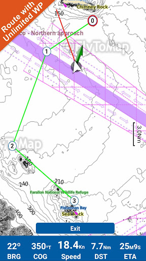
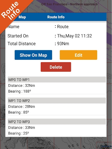
√ Route with unlimited waypoints
√ With Head Up and Course Up feature
√ Geocompass
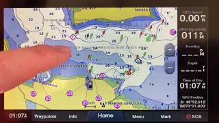
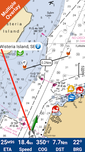
√ Navigate and see your GPS position on the map
√ Heading Vector Towards the direction movement
√ Distance Measurement Tool to easily calculate the distance from one location to another
√ Insert the target/destination and see in real time your speed, distance and bearing
√ background mode - Flytomap works in background as well, you can swap with another app and receive/make calls send sms while panning and zooming.
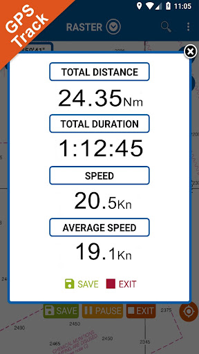
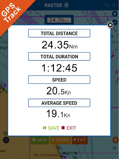
√ Unlimited Tracks share via email, visible on Google, Flytomap Viewer, KMZ format - Store your track without the need of cellular data or mobile signal
√ KMZ KML from / to GPX Converter
√ Optimized battery usage
√ ActiveCaptain
• View and contribute to the best boaters community available in the world
• Continuous update of all info (including reviews from the deck) about :
• Marinas
• Anchorages
• Hazards
• Local Knowledge
√ And so much more to come - It’s the only app you will ever need! Our charts are installed on: GARMIN NAVICO LOWRANCE B&G NORTHSTAR EAGLE SIMRAD
Follow us:
▶Twitter @flytomap
▶Web Site flytomap.com
▶Web App viewer.flytomap.com
▶Facebook facebook.com/flytomap

9Apps 4.9