
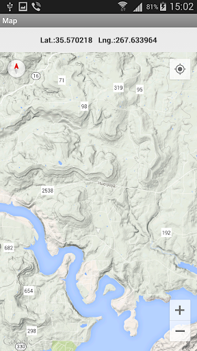
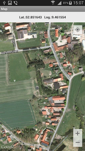
Topographical calculations for UTM. Grid on the map.
Calculations in full or brief coordinates, in one or in the adjacent zones.
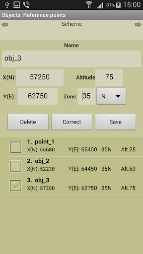
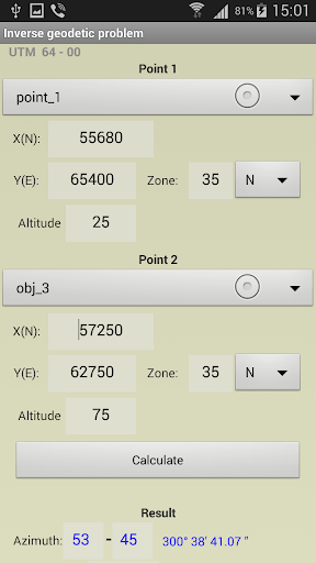
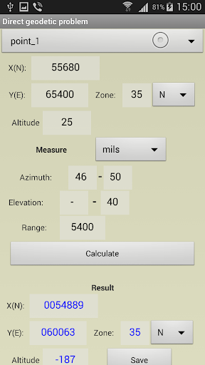
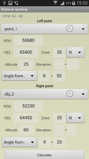
Rectangular coordinates in meters. Altitude, range in meters.
All angles on scale 64-00 or 60-00 (settings option on main screen).
In DGP and IGP angles are available in degrees - minutes – seconds.
GPS location in rectangular coordinates.
Azimuth of the Sun, the Polaris in specified time.
Maintain a list of objects that may be used in which the tasks (250). In free ver. - 3.
Read / write and append data from a file. The data file may edit/prepare a text editor, transfer methods available.
Google Maps, ArcGIS, MapBox, prepared ofline-atlases with markers points from the list (only with full coordinates).
Atlases in the format *.mbtiles can be created in SAS Planet, MobAC. Based on osmdroid.
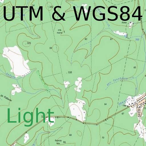
UTM-Grid on the map.
When you touch the marker shows the number and name of the point.
When you touch the map shown rectangular coordinates of the location.
Maps are cached (accumulated) to work without a network.
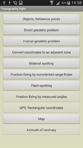
Tasks list:
Direct geodetic problem;
Inverse geodetic problem;
Convert coordinates to an adjacent zone;
Localizing with paired observation (readout from the base or directions);;
Binding undirected rangefinder (range up to 2 known points);
Binding by measured angles(between the left-middle and middle-right known points with anchor points);
Binding according to GPS (geodetic and rectangular);
Azimuth of luminary;
Localizing with a stopwatch (with the air temperature);
Map.
Settings:
- Maps ( Google / ArcGIS / MapBox / prepared offline-atlases);
- The scale of thousandths (60-00 , 64-00)
- Color style
- The type of map (topographic, satellite, hybrid)
- Type of marker points on the map
- Grid on the map (no , 1km , 2 km )
- Save data to a file, read / write and append data from a file.
The program is distributed "as is". Its use - discretion and responsibility of the user.
All tasks and all the features available in the full version.
The free version has some ads.
MGRS.


9Apps 4.9


