
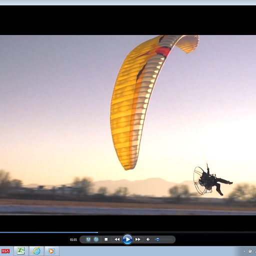
Adventure at your fingertips!
GoFly combines GPS with variometer to precisely trace 3D movement and to help you navigate.
It aims to give you useful information, so you can have better control over the situation as you move in the air and on the ground.
Check parameters of your movement on the fly. Record all your tracks for further analysis and comparison. Track your progress and best records. Manage your spots and photos. Share and export data with ease.
KEY FEATURES:
- variometer and GPS,
- 3D track recording,
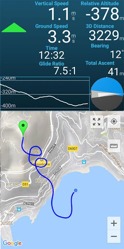
- real-time data: ground and vertical speed, elapsed time, glide ratio, relative altitude, bearing, total ascent, 3D distance travelled,
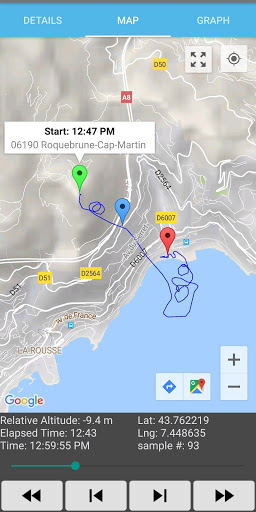
- path drawing on the map,
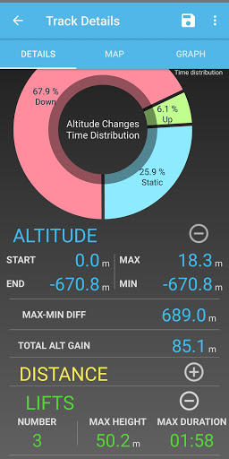
- graph for altitude changes,
- glide ratio visualization for different time periods,
- sound, vibration and voice notifications,
- background recording,
- track to a GPX file export,
- waypoints with distance,
- share your position with bearing,
- terrain, satellite, hybrid, or basic map option,
- map ruler to quickly measure distance,
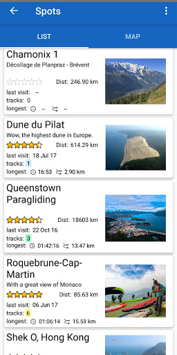
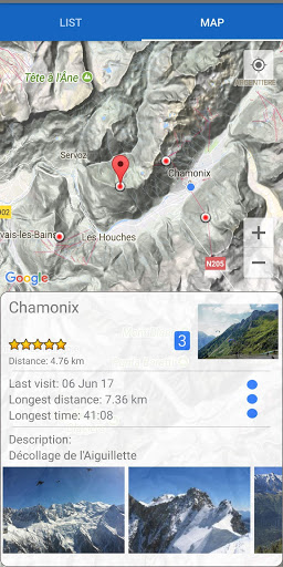
- spots management, with location, description, rating and photos,
- spots visualized on a map,
- separated stats for each spot,
- check distance and driving directions for every spot,
- browse and sort all your tracks,
- each track can be attached to a spot,
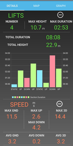
- analyse your results in detail, with date, duration and distance
- find out the number and total duration of lifts,
- discover your top speeds, ground, vertical and 3D,
- check location, time and altitude of every recorded track point,
- GoFly automatically divides a track into up/down/static sections,
- check your flight climb to sink proportion, and how long each section lasted,
- find out where you climbed the most,
- charts and gauges make complex data accessible, instantly.
- add photos from your phone gallery or directly take a new one,
- no account, no subscription required,
- all data is stored on your phone,
- Internet needed only to update the map and show driving directions,
- share you tracks, spots and photos with ease
** USING DEVICE WITH A BAROMETER SENSOR IS RECOMMENDED FOR BETTER ALTITUDE MEASUREMENT **
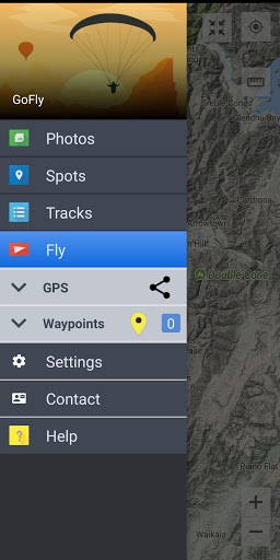
GoFly consists of 4 different sections:
FLY - record your 3D movement and watch your progress. Your path on the map and altitude changes will be shown on the screen. You will be informed about lifts and drops. You can check your glide ratio and how it changes over time. Get real-time values of vertical and ground speed, bearing, relative altitude, 3D distance travelled, total ascent,
TRACKS - where all your previously recorded Tracks are stored, so you can analyse your results in detail. GoFly gets all the calculations done to present you the data in an accessible way with charts and map. Find out the number and total duration of lifts. Discover your top speeds, ground, vertical and 3D. Check maximum altitude, vertical and 3D-distance travelled.
SPOTS - where you can create a list of your favorite Spots, with a location, rating and Photos. A Spot is a place where you start your Track. All Tracks that originate from one Spot are included in this Spot's stats. GoFly compares all Tracks for each Spot and shows your best performance in terms of flight duration and distance travelled.
PHOTOS - Store and group all your images in-app for easy viewing and sharing. Each photo is attached to a Spot, so no matter what you do it will always stay organized. Hundreds of photos on your phone? With GoFly, anything unwanted is filtered out. You can add photos from your phone gallery or directly take a new one.
Trial period extension


9Apps 4.9