

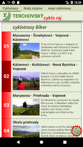
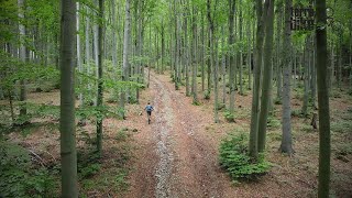
MTB cycling routes for all lovers of mountain biking, who like to cycle in the Slovak mountains. This time we will focus on Terchová - Mala Fatra region, where some enthusiasts have created a maintained network of cycling trails - cycling paradise.
The application also includes many GPS, map and cycle functionality, all that biker needs. Also offline maps are available. Function map magnification enables good readability of the text.
Route Description GPS
The description of each route includes text, photos, GPS trackpoints, and so-called Points of Interest (food & drink...). GPS trackpoints and the Points of Interest will be displayed on the map.
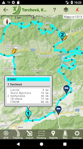
Maps
The app contains offline maps of region Terchová, which are independent on internet connection. In addition, several other online maps are available. All maps can be zoomed. Very useful is Magnification function, to adjust the font size for a small screen. Of course, it is possible to orient the map in the direction of travel, or by compass.
The following maps are currently available:
- Freemap.sk/hiking
- Freemap.sk/cyclo
Navigation
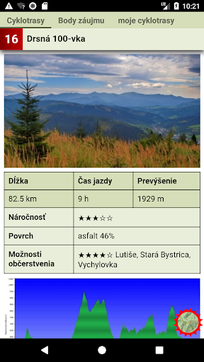
The apk provides all functions, what you need in terrain, like voice navigation and watching progress related to the elevation profile. The quality of navigation depends on how you get the route.
Routing & Planning GPX Editor
Finds route from point A to point B with option Road - Bicycle - Hiking. Route is calculated by OpenStreetMap or MapQuest server. You can also use comfortable GPX Editor to draw or edit your own route. Elevation profile is generated automatically. Distance and slope measurements are possible. The application supports data synchronization via the Dropbox or Google drive cloud storage.
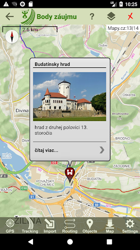
Objects - Points of Interest
The application downloads various types of objects, that are interesting for cyclists (accommodation and restaurant facilities, water springs, cultural and historical objects...). Optionally, the objects appear on the map.
Tracking - Track Recording
The app records the track, you have traveled. The log contains not only GPS coordinates, but also information about time and altitude. Trackpoints, including title and photos, can be added to the log. Live Tracking lets you track your location on the web server.
Dashboard
If Tracking is turned on, it is possible to call up a dashboard with functions similar to a cycling computer:
- total time
- distance traveled
- ascending height meters
- height above sea level
- maximum altitude
- instant, maximum and average speeds
Social Networks
The application is able to access social networks and share their own routes or routes in this app.
new design
smart watch support
higher map scale
live tracking
maps directly in the apk
voice alert
watching progress on the route
categories of points of interest
![VELKA FATRA MTB 2022 - [story 19] screenshot 1](https://i.ytimg.com/vi/ZG_m_T0boFU/mqdefault.jpg)


9Apps 4.9


