PhotoTag GPS – Map Camera icon

PhotoTag GPS – Map Camera

1.3 for Android
3.0 | 10,000+ Installs

Metizsoft Solutions

Description of PhotoTag GPS – Map Camera

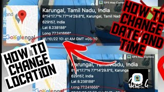
Have you taken a picture when you go to travel? We recommend you to enable your Camera's GPS. Try PhotoTag GPS - Map Camera.
Once you enable GPS - Map Camera function, The GPS longitude & latitude will trace in the captured photos.
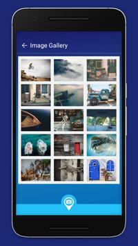
This Application allows you to browse your photos by GPS position, Re-live your journey and re-discover wonderful moments you have long forgotten!

Information

  • Category:
    Maps & Navigation
  • Latest Version:
    1.3
  • Updated:
    2018-12-07
  • File size:
    11.6MB
  • Requirements:
    Android 4.0.3 or later
  • Developer:
    Metizsoft Solutions
  • ID:
    com.metiz.gpsphoto
  • PhotoTag GPS – Map Camera
    PhotoTag GPS – Map Camera 1.2
    11.3MB
    2018-12-06
    APK
    Picture
  • PhotoTag GPS – Map Camera
    PhotoTag GPS – Map Camera 1.0
    3.8MB
    2017-10-07
    APK
    Picture