
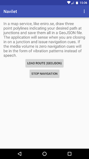
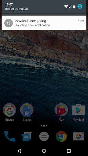
Navigation of manually defined routes. Routes are defined by a set of three point polylines that indicate your desired path at junctions. The application will sense when you close in on a junction and issue navigation cues as speech or vibration patterns. A typical scenario would be to draw the route in eniro.se on a desktop/laptop, save all the polylines in a GeoJSON file and then load it into the application when you want to navigate the route. Storing the route file on Google drive is a good way to make it accessible from your phone. Check out the video for a run-through of the typical scenario.
Great for walking, running, and cycling. The application can even be used for countryside motorcycle tours.


9Apps 4.9


