No ads even in the free version!
Perfect for hiking, riding, cycling, running, skiing or orienteering
Premium topo maps
Use in-app purchases to subscribe to high-quality, special-purpose maps. Flexible offline mode and competitive pricing.
• OS OpenData (GB)
• IGN TOP25, TOP50, Cadastre, Satellite and Littoral (marine maps) (FR) http://www.frogsparks.com/mytrails/ign/
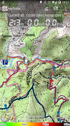
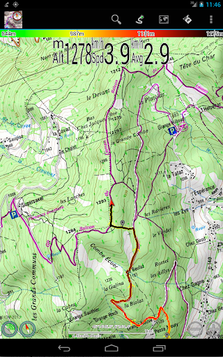
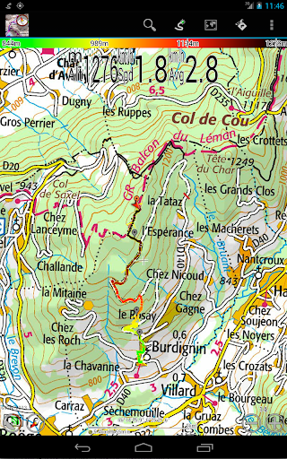
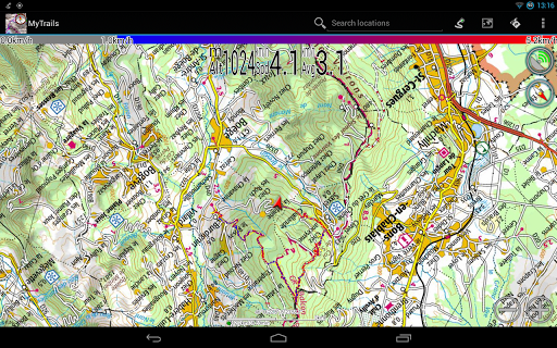
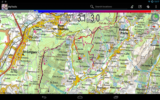
Full-screen trail map oriented with the built-in compass and GPS
Know exactly which direction you are going.
Uncluttered map area, with unobtrusive controls and a traditional scale with track duration and distance.
Hardware-accelerated map drawing allows smooth and snappy display even with tens of thousands of track points.
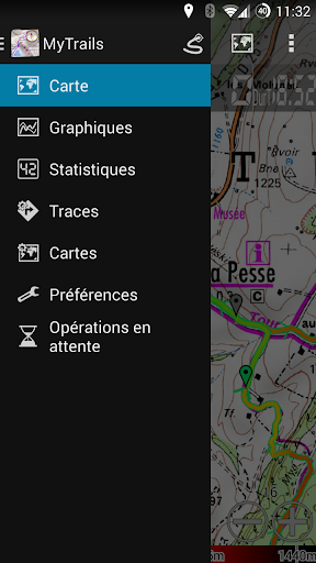
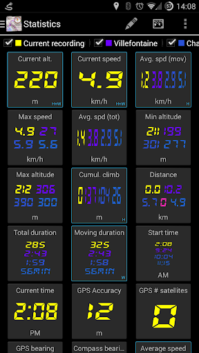
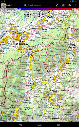
Stats
40 stats to choose from!
Display them on a dedicated screen (including stats for multiple tracks at once), on the HUD overlaying the map or even on Android Wear.
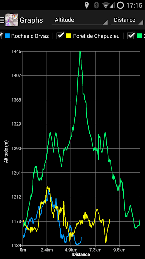
Graphs
Freely define axes (over 30 combinations) to visualize your tracks, including elevation profiles, speed vs. time, etc.
Free online maps
Pick from many built-in online map sources (OpenStreetMap, Yahoo, Bing, Google and many other global and local providers).
Add more map sources using the configurable map sources (URL or WMS).
Only premium maps are guaranteed: we may be forced to remove access to any of the free maps if requested by the rights-holders; this is regardless of whether you are using the Pro or Free version.
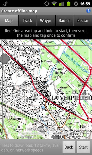
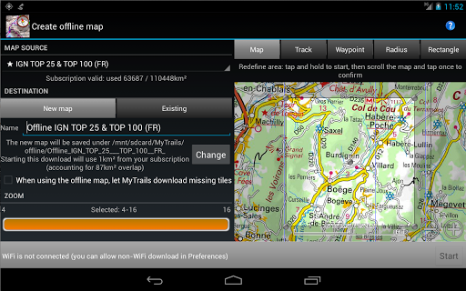
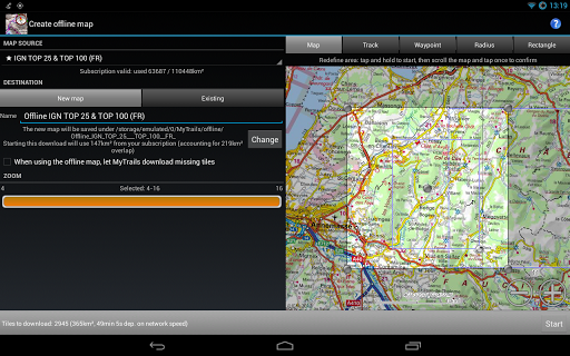
Offline maps
Save battery and data charges.
The map displays instantaneously.
No need to use desktop-based tools to create offline maps, you can do it in MyTrails, in the background.
Record GPS tracks
Visualize your track at any time and analyse your course during or after the outdoor activity.
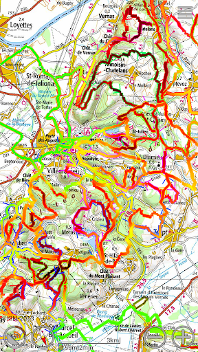
Display multiple colorized GPS tracks at once (Pro)
Visualize your previous outings and those uploaded to GPS community sites, so that you always pick a great trail.
Visualize the key indicators of the track (altitude, speed, rate of ascent, slope, GPS accuracy, etc.) right on the map with a detailed legend.
Waypoints
Manually add waypoints to indicate memorable spots or upcoming turns.
Waypoints are automatically generated when getting directions or when you take a break.
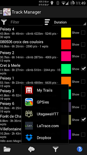
Share and archive tracks (Pro)
Share your tracks on My Trails, GPSies, UtagawaVTT and la-trace.com.
Download tracks shared by other users in your vicinity.
Gestures
Easily switch between active maps by swiping three fingers left to right in the map view.
Pull down the HUD with information on your speed and altitude by swiping three fingers down your screen.
Full tablet support
Plan your outing on a large-screen tablet, go out and have fun, and when you're back, view the track in full glory.
Use Dropbox to seamlessly synchronize between devices.
FAQ: http://www.frogsparks.com/faq/
Permissions: please see the FAQ
Fix creating offline map for paid multi-layer maps
Share URL map definitions (in map edit screen)
Android 10 support
Fix Google search, directions and altitude
Changelog: https://www.mytrails.app/support/history/


9Apps 4.9