

Developed by CHC Technology Co., Ltd(www.chcnav.com), LandStar 7 is the newest field-proven software solution for Android. Designed for high precision surveying and mapping tasks for your everyday work.
If you are new to LandStar 7, you will be impressed by its seamless work mode management, easy-to-use and easy-to-learn graphical user interface with simple operation. Extensive data import/export formats and multiple types of measurement and stakeout methods ensure instant productivity.
Top Features:
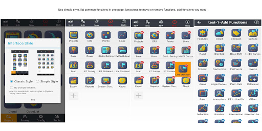
1.One-button Switching Dual Styles
Simple Style, for entry-level surveyors, with basic functions in one screen.
Classic Style, for professional surveyors, with all functions showing in different tables based on the frequently used work flow.
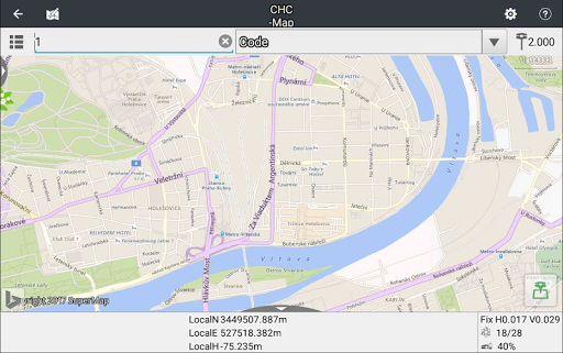
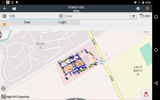
2.Various Base Map Displays
OSM, BING, Google, WMS online maps.
DXF, SHP, TIF, SIT, KML, KMZ offline maps
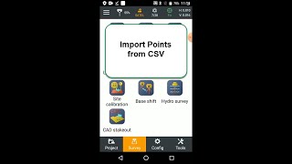
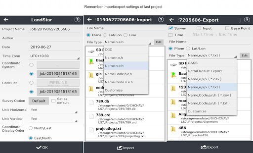
3.Extensive Import and Export Data Formats
Import from DXF, SHP, KML, KMZ, CSV, TXT and CGO formats.
Export to DXF, SHP, KML, KMZ, RAW, HTML, CSV, TXT formats.
Customized import and export contents in CSV or TXT formats.
4.Various Types of Measurement
Supports static, RTK and stop & go measurement.
7 methods of point measurement, including topographic point, control point, quick point, continuous point, offset point, EBubble compensated point and corner point.
5.Various Peripherals Supported
Pipeline detector, VIVAX-METROTECH vLocPro2.
Laser rangefinder, Leica Disto,SNDWay and Bosch.
Echo sounder, sonarmite,NMEA DPT and DBT.
6.Convenient Work Mode Management
Presetting common work modes of base and rover, switching work modes by one button.
Convenient to work in stop&go based on real-time kinematic (RTK) mode and static mode can be set at the same time.
7.Standard CGD correction file
CHCNAV own CGD file for grid/geoid correction. Datum grid, plane grid and height geoid files are integrated in one CGD file, and each CGD file name is corresponding to coordinate system.
Multiple grid formats are available, GGF, BIN,GRT, GRD, GSF, GRI,BYN,ASC.
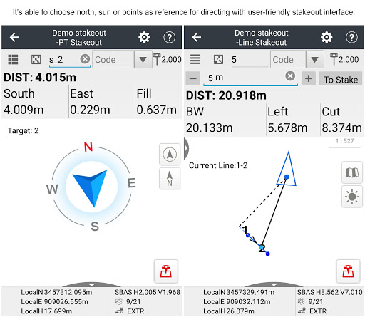
8.User-friendly Stakeout Interface
Two modes for stakeout, map mode shows the current position and target position, compass mode shows the target direction.
Users can set North, Sun or point as a reference direction.
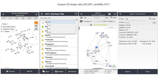
9.Multiple Types of Stakeout
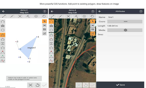
Point and line stakeout by snapping feature point on DXF base map or survey point.
Surface stakeout with 3D DXF, XML, HCT formats.
10.Correction Repeater Function
Easily repeating correction data from RTK network or radio mode to other rovers via radio.
RTCM Transformation Message
Using RTCM transformation messages (1021-1027) for datum transformation, projection, automated grid position and geoid adjustments.
11.CHCNAV Cloud Service
Allows for uploading and downloading projects, coordinate systems, work modes and code lists.
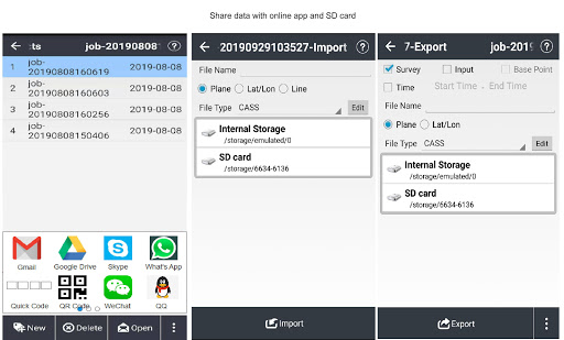
12.Quick Data Share
Use Gmail, WhatsApp, Google Drive, Skype to share your data
Share your projects, coordinate systems, points, work modes, codes, reports and results.
13.Powerful Road Functions
Create road elements in field, perfectly match your design data.
Support center line, cross section, profile, slope, structure, culvert and stakes.
Different views are available for stakes, slope, structure and data check.
14.Field Hardware Support
Supports CHC i90 with firmware v2.0.11, i80/i70/M6 receiver with the firmware v1.6.55, i50 receiver with the firmware v1.0.38, X91 /X900 receiver with the firmware v8.39 and above, as well as internal GPS of Android smartphone and handheld controller.
15.Data Collection Hardware
LandStar 7 used with CHC HCE320 is the most compatible way, it can also be used with CHC HCE300, LT600, LT700, LT700H or other Android devices of v4.2 and above.
16.Language support
LandStar7 is available in Bulgarian, Croatian, English, Finnish, French, German, Greek, Hungarian, Iranian, Japanese, Kazakh, Korean, Persian, Polish, Portuguese, Russian, Simplified Chinese, Spanish, Slovak, Thailand, Traditional Chinese,Turkish,Mongolian and Vietnamese.
1.Add Dutch local coordinates,support GTX geoid file.
2.Support GDM export.
3.Support GNSS reciever i73.
4.Support dual-frequency depth sounder Hydrolite DFX.
5.Optimize the function of road stakeout.
6.Optimize SD card read & write.
7.Optimize the surface fitting method.
8.Fixed some other known bugs.


9Apps 4.9