Moje PMDP icon

Moje PMDP

1.0.49 for Android
3.4 | 10,000+ Installs | Reviews

PMDP, a.s.

Description of Moje PMDP

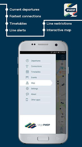
“My PMDP” helps city residents and visitors navigate Pilsen’s public transportation system.
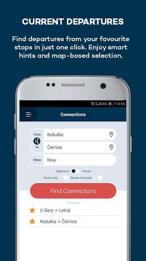
Find out departure times from individual stops or for entire routes. The times are always up-to-date, including any delays. To add convenience to your daily commutes, save your stop under “favourites” or simply pick a stop closest to you.
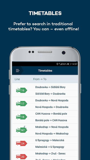
Would you rather look at a classic timetable that is displayed at stops? They, too, are available in the app and work even when you’re not online.
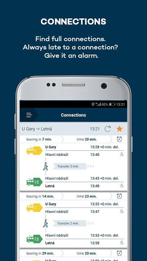
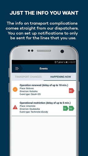
The application will warn you about any traffic accidents or other events that may cause public transportation delays. To keep these messages from pestering you, simply set the alerts only for your favourite routes. You can also learn about all planned transportation changes.
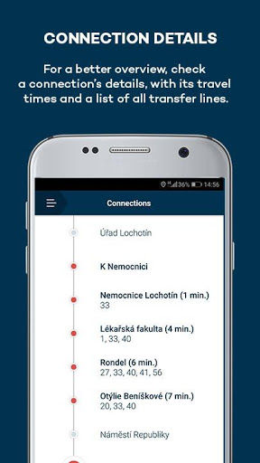
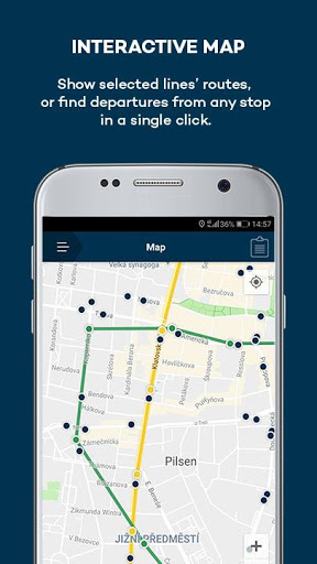
If you don’t ride Pilsen public transportation every day, the interactive map will be of special help. You can see the transport routes for select lines, or choose any stop to see all of the lines that service the stop and click to see their departure times.

What's New with Moje PMDP 1.0.49

Speed up loading of offline timetables. Support for new versions of Android.

Information

  • Category:
    Maps & Navigation
  • Latest Version:
    1.0.49
  • Updated:
    2021-06-24
  • File size:
    6.9MB
  • Requirements:
    Android 4.4 or later
  • Developer:
    PMDP, a.s.
  • ID:
    cz.programm.dpmp.mojepmdp
  • Available on:
  • Moje PMDP
    Moje PMDP 1.0.45
    5.7MB
    2021-04-26
    APK
    Picture
  • Moje PMDP
    Moje PMDP 1.0.43
    5.7MB
    2020-09-29
    APK
    Picture
  • Moje PMDP
    Moje PMDP 1.0.33
    5.6MB
    2020-09-29
    APK
    Picture
Reviews
  • avatar
    Missing so many stations
    2020-01-26 09:22
  • avatar
    Ocenil bych možnost stažení jízdních řádů do offline
    2019-08-02 08:27
  • avatar
    Aplikace se pokaždé načítá nesmyslně dlouho. Nepoužitelné, pokud spěchám.
    2018-11-13 04:17
  • avatar
    Fajn apka. K dokonalosti mi chybi aktualni poloha, kde je spoj (resp. posledni zastavka, kterou uz projel). Kdyz rozkliknu konkretni spoj a vidim seznam zastavek, tak by tam ta aktualni mohla byt zvyraznena a posouvat se. Google maps uz neco podobneho umi, ale urcite je to jen dopoctene, tady by to mohlo byt z online dat. Taky by nahore mohlo zustat info, na detail ktereho spoje zrovna koukam.
    2018-10-19 08:46