
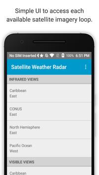

View recent weather satellite imagery loops from the NASA Geostationary Operational Environmental (GOES) satellite.
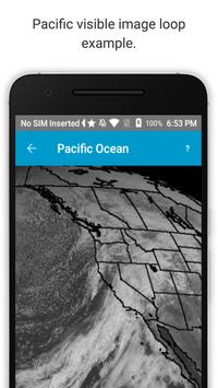
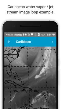
This app includes infrared, visible, and water vapor views.
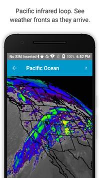
On the infrared maps, gray represents relatively warm temperatures, blues cooler, and red indicates clouds that are the coldest, tallest, and most likely to produce rain.
This app is especially good for seeing fronts, tropical storms, and hurricanes well before they arrive.
New data frames come once every 15-minutes, usually, and are added onto the end of the animations automatically.
These loops are optimized for quick load times and low mobile data use. All loops are ~ 1 MB in size.
Please pan the images to see everything available.
Currently available loops:
East - CONUS (Continental United States)
East - North Hemisphere
East - Caribbean and West Atlantic Hurricane Region
West - Pacific Ocean
Global Weather Satellite Composite (note non-North/South American data is only available once every six hours, due to international agreement).
Image timestamps are displayed in UTC, but your local timezone offset is made available for reference.
This app is not affiliated with NASA.


![Golden Earring - Radar Love (Official Music Video [HD]) screenshot 4](https://i.ytimg.com/vi/aRlSHG5hRY4/mqdefault.jpg)

9Apps 4.9


