


Project ID: HUSRB/1602/11/0097
Acronym: URBAN-PREX
Background Of Extreme Precipitations and Pluvial Floods in Urban Areas
Urban areas are characterized by higher precipitation amounts and intensity (when compared to a rural area) as a consequence of convection processes generated by higher temperatures in cities (i.e. urban heat island effect) and due to an increased amount of microscopic condensation nuclei due to human activities.
Due to the large extent of artificial material and lack of vegetation, atmospheric water is redirected into sewage and storm drain systems. High intensity precipitation can cause flooding when the city sewage system and draining canals do not have the necessary capacity to drain away the amounts of rain that are falling. Water may even enter the sewage system in one place and then get deposited somewhere else in the city on the streets.
Extreme precipitation and urban floods are a great disturbance of daily life in the city. Roads can be blocked and people can’t go to work or to schools. The economic damages are high but the number of casualties is usually very limited, because of the nature of the flood.
Several important projects in the world addressed this issue such as EU RainGain in Rotterdam, Paris, London and Leuven, EU FLIRE in Athens or RAMSES in several European Cities. Furthermore, in a few Universities this issue is a focus of research, such as Newcastle University. The URBAN-PREX project is a new step in researching the urban pluvial floods in European cities.
Project Summary
Climate change is expected to increase the frequency and intensity of precipitation and pluvial flood occurrences in urban areas of Central Europe. Thus, the proposed project presents an outstanding opportunity to develop and implement an innovative monitoring, forecasting and online public early warning system for extreme precipitation and pluvial floods in urban areas of the Hungarian-Serbian Cross-border region.
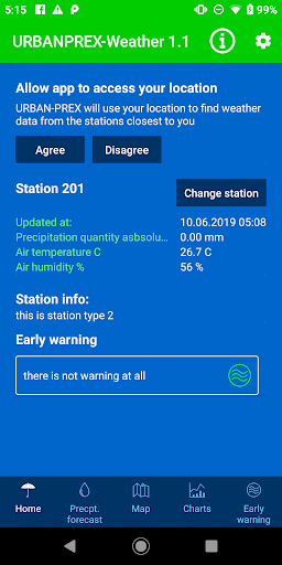
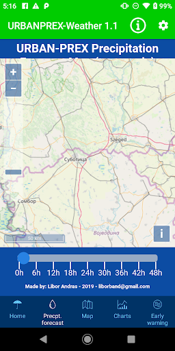
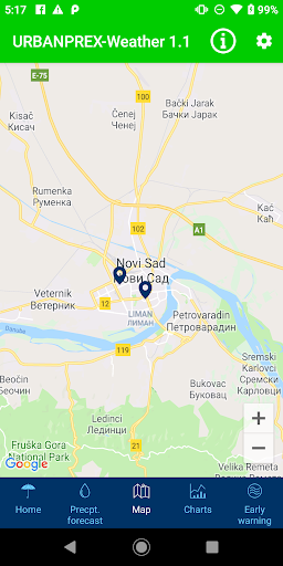
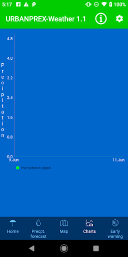
Through the project, two dense monitoring precipitation networks will be installed in the most-populous cities of the Programme area: Novi Sad (Serbia) and Szeged (Hungary). Continuous data recording, transmission and processing, as well as real time display of the processed data in a spatial (i.e. map) form will be useful for citizens (i.e. individual adaptation) and public institutions (e.g. traffic and water management, city government) of the Cross-border region.
Real-time precipitation forecasting model for the whole Programme area supplemented with the forecast of pluvial flood occurrences in Novi Sad and Szeged will be developed through the project based on the measured data from the networks and the remotely sensed data. Measured data will be used to fine-tune the remotely sensed data thus enabling the development of more precise forecast model for the Programme area.
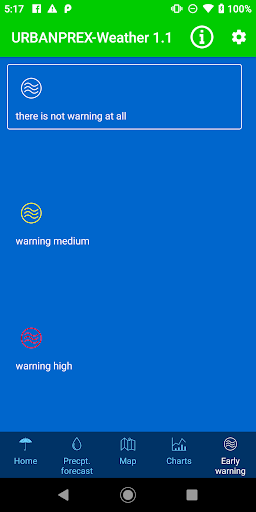
Measured and forecasted data will be freely available for everyone in real-time on the project website, project social pages and mobile android application giving an early warning to the citizens and public authorities in order to protect them and prepare their effective response to these extreme weather and water situations.
Project’s Main Objective
Project main objective is development of monitoring, forecasting and public early warning system for extreme precipitations and pluvial floods in urban areas of the Hungarian-Serbian Cross-border region. Measured and forecasted data will be freely available for inhabitants and authorities.
Bug fixes.


9Apps 4.9


