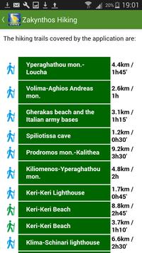
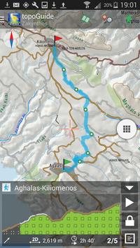
Zakynthos Hiking is a digital field guide for hiking and touring in the Zakynthos Island. It includes routes, descriptions and photos for 27 hiking trails, covering the whole Zakynthos Island. Each Adventure has a description, photos and a POIs list.
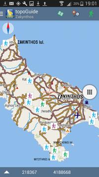
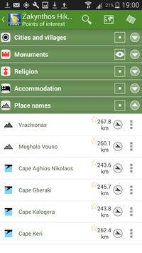
The application offers detailed off-line maps and a concise introduction on geography, geology, the history and the nature of Zakynthos Island. The app offers also a useful list of POIs with a comprehensive search engine.
The trails list includes easy walks, easy and moderate hiking trails of a total length of 116 km. Six of the trails are serially connected and can compiled to create a 3 to 6 days crossing of Zakynthos. This 49 km - long traverse is named The Zante Trail.
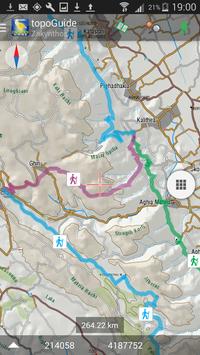
In the field, the application identifies the nearest route and make active navigation to it and then along it, with continuous messages to the user, while pops-up photos on every interesting or important terrain feature close to his position. If the hiker position is more than 20 meters far from the trail, the application warns him and suggests how to go back.
The cartographic company AnaDigit, creator of the application, has issued hundreds hiking maps for Greece (eg. maps of Crete, Zagori, Sifnos, Naxos and other Aegean islands). To build the application and ensuring data accuracy, all tracks and cartographic information have been recorded during 20165.
New: A trip computer added
New: GPS info added


9Apps 4.9