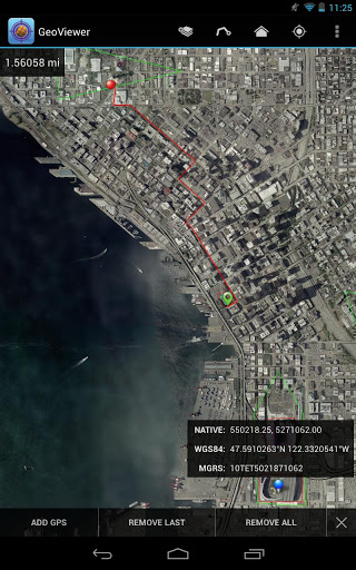

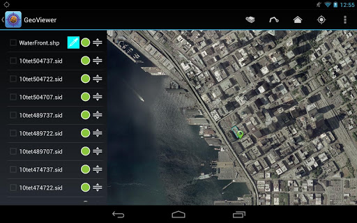
GeoViewer puts high resolution imagery right at your fingertips. GeoViewer enables you to view, pan and zoom MrSID and JPEG 2000 images on your Android device using familiar touch gestures. Open raster and vector layers, measure distances, find locations on maps using GPS, and more.
Things you can do with GeoViewer:
• Open MrSID and JPEG 2000 images.
• Select bands to view from a multispectral image.
• Explore imagery by panning, zooming in and zooming out.
• Add vector overlays (Esri Shapefiles and KML files) to get more out of image layers.
• Center on your GPS location so you can see what’s nearby.
• Measure the distance between a series of points.
• Identify geolocation by touching on any image.
• View layer properties, including coordinate reference system, geo bounding box, dimensions, colorspace, datatype, and resolution.
• Search by geographic coordinates in WGS 84 (Lat/Long) or the image’s native coordinate reference system.
• Set viewing preferences (band selection, layer line color, etc.).
By installing or using this App you agree to be bound by the terms and conditions of the End User License Agreement, https://www.extensis.com/geoviewer-for-android-eula.
Bug fixes.
9Apps 4.9