
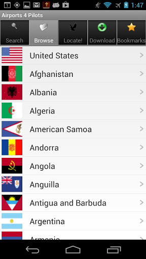
Airports 4 Pilots is the most comprehensive database of public and private airports, heliports, gliderports, balloonports, STOLports, ultralights and seaplane bases, covering over 26,000 facilities in all 218 countries and regions of the world, from Afganistan to Zimbabwe.
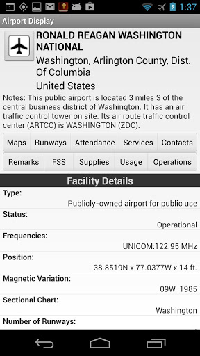
Detailed information is provided on most facilities, including runways, remarks, fuel and services available.
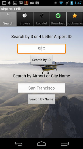
Use Airport 4 Pilots in all preparatory and executional modes: including flight planning and en-route lookup.
Airports 4 Pilots also includes an emergency "Locate" feature that uses the GPS on your phone to locate the nearest landing facilities, along with directions and distance to each nearby airport.
A great utility to use if you are running low on gas.
"Tremendous app: very useful and helpful, with lots of important information at the touch of a finger"
- WRoberts, Chicago
"Lots of info an[d] nice map integration. Good to have offline at some remote airport or location … AOPA should use th[is] instead …"
- FRG Pilot
"Well Done! Very nice App! Pulls up information on the airport in just a couple of seconds. Could really save the day in a real emergency…"
- KD
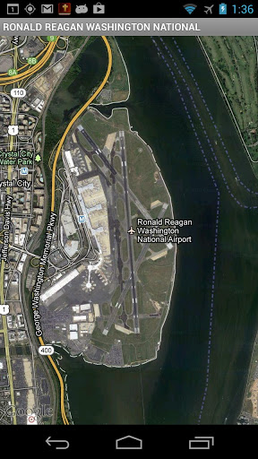
"Well done. Especially like the satellite view of the runway and surrounding area. The amount of data and information is impressive…"
-CT
"What an extremely imformative app… The developer did their homework on this one, put so much information in, that you can almost do your flight planning from this app. I have to say it is now one of my favorite avaition apps. I really believe all pilots should invest in this app, you won't go wrong."
-MD
"All the information you need for airports in a simple but extremely informative format especially when you need it the most…"
-RP
Having aircraft engine trouble? Running low on fuel? No more crash-landing in the parking lot! Airports 4 Pilots will dynamically provide you with a list of the closest landing facilities, public and private, sorted by distance to your present location, and will give also you directions to each located facility, as well as provide a map and comprehensive information on your chosen landing spot.
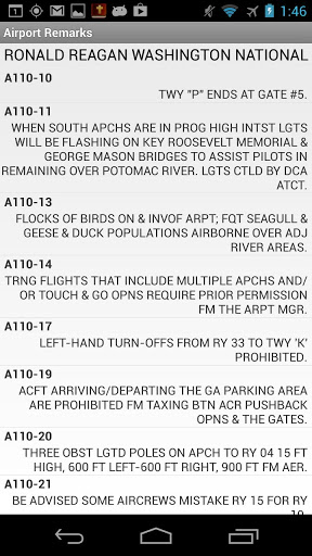
Airports 4 Pilots provides extra great detail for all public, private and military facilities across the United States, Puerto Rico, Virgin Islands, and Pacific Territories. It includes detailed information on each facilities' runways, operations, contacts, services, supplies, frequencies, FSS and more. It also includes current FAA remarks for each facility, as well as satellite imagery and maps.
Airports 4 Pilots sources current data from a range of sources including the FAA and covers the entire WORLD, from Afganistan to Zimbabwe!
Extra detail coverage is included for ALL US regions areas - Northwest, Southwest, North Central, South Central, East Central, Northeast, Southeast, Alaska, Pacific / Hawaii.
Airports 4 Pilots is fully self contained and does not require an internet connection to operate (with the exception of maps and satellite imagery). Updated data, when released, will be made available via the Google Play Store.
NOTE: Global Database is available by regional in-app purchases, with the entire USA and territories included free.
Airports 4 Pilots was designed and developed by Ndili Technologies, Inc.
Lite version allows 3-day free trial.
It requires GPS permissions for its emergency LOCATE! feature.


![Best Carry-On Luggage 2024 [don’t buy one before watching this] screenshot 5](https://i.ytimg.com/vi/f0nwvBaBVEU/mqdefault.jpg)
9Apps 4.9


