
NOAA Weather Satellite Radar is an a free real time NOAA weather radar and NOAA weather satellite app for NOAA radar images and NOAA Satellite Images. You can see noaa weather radar live important images for accurate weather. You can track the cloud formation and movements from noaa weather radar live images and live satellite weather of us images. Animated storm radar images and satellite images are also available in this app.
You will get here high resolution noaa weather Satellite Images and noaa weather Standard Radar Images. This is a noaa weather app free version. It is mainly a noaa weather Satellite and noaa weather radar app. You can download desired images with a easy button click.
Key Features of NOAA Satellite Weather app:
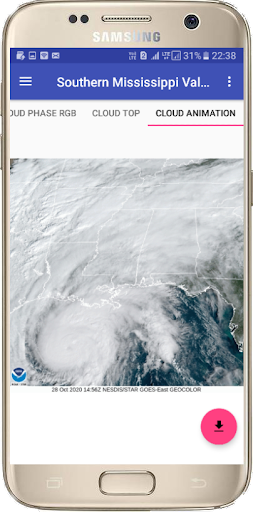
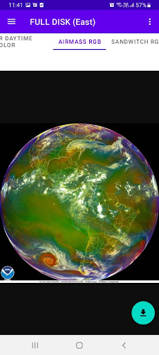
🌟 This is Live NOAA GOES satellite images App.
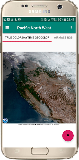
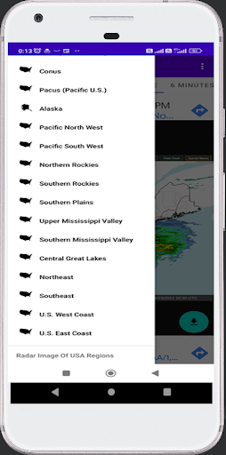
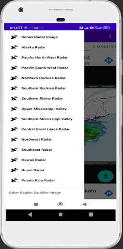
🌟 Latest weather Satellite Images of United States of America Sector .
🌟 Latest weather Satellite Images of Canada Sector.
🌟 Latest weather Satellite Images of Mexico Sector.
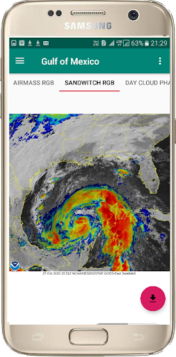
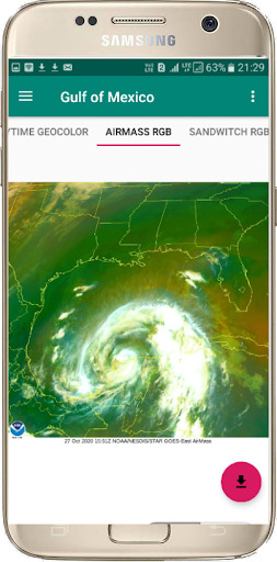
🌟 Latest weather Satellite Images of Gulf of Mexico Sector.
🌟 Latest weather Satellite Images of Central America Sector.
🌟 Latest weather Satellite Images of Caribbean.
🌟 Latest weather Satellite Images of Northern South America Sector.
🌟 Latest weather Satellite Images of Southern South America Sector.
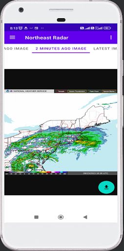
🌟 Every 10 minutes radar image updated.
🌟 Change your desire city and see the clouds position.
🌟 Satellite Clouds Animation.
🌟 Best satellite weather map live America.
The GOES satellites is a Geostationary Operational Environmental Satellite (GOES), operated by the United States' National Oceanic and Atmospheric Administration (NOAA), support weather forecasting, tropical cyclone tracking, and meteorology research.
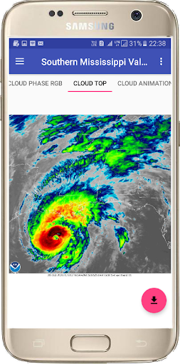
GOES is the latest weather satellite. It is most prominent and clear to know the latest weather condition. GOES satellite image cover more countries like united states of America, Canada, Mexico , Central America, Northern South America, Southern South American countries.
This App gives you the easy view of latest image of NOAA GOES satellite and easy unlimited download of your desirable Satellite Clouds images.
NOAA's Polar-orbiting Operational Environmental Satellites (POES) satellites have provided the backbone of the global observing system, operated by the National Oceanic and Atmospheric Administration ( NOAA), support weather forecasting, tropical cyclone tracking, and meteorology research.
NOAA-15, NOAA-18, and NOAA-19 are the latest weather satellites. It is most prominent and clear to know the latest weather condition. NOAA Satellites cover more countries like America, Canada, Mexico, Central America, Caribian Sea, south America countries.
This App gives you the easy view of latest image of NOAA Weather Satellite and easy unlimited download of your desirable images.


9Apps 4.9


