


Key Features of NOAA Satellite Weather app:
🌟 This is Live NOAA GOES satellite images App.
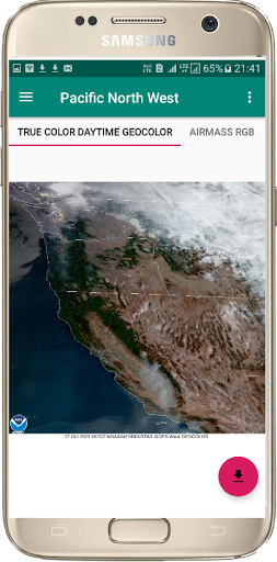
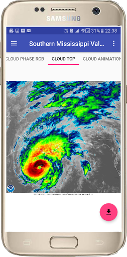
🌟 Latest weather Satellite Images of United States of America Sector .
🌟 Latest weather Satellite Images of Canada Sector.
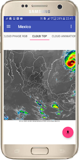
🌟 Latest weather Satellite Images of Mexico Sector.
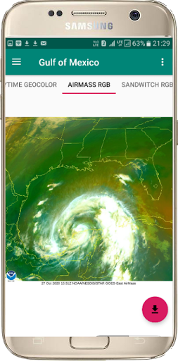
🌟 Latest weather Satellite Images of Gulf of Mexico Sector.
🌟 Latest weather Satellite Images of Central America Sector.
🌟 Latest weather Satellite Images of Caribbean.
🌟 Latest weather Satellite Images of Northern South America Sector.
🌟 Latest weather Satellite Images of Southern South America Sector.
🌟 Every 10 minutes radar image updated.
🌟 Change your desire city and see the clouds position.
🌟 Satellite Clouds Animation.
🌟 Best satellite weather map live America.
The GOES satellites is a Geostationary Operational Environmental Satellite (GOES), operated by the United States' National Oceanic and Atmospheric Administration (NOAA), support weather forecasting, tropical cyclone tracking, and meteorology research.
GOES is the latest weather satellite. It is most prominent and clear to know the latest weather condition. GOES satellite image cover more countries like united states of America, Canada, Mexico , Central America, Northern South America, Southern South American countries.
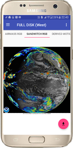
This App gives you the easy view of latest image of NOAA GOES satellite and easy unlimited download of your desirable Satellite Clouds images.
Some Layout has been Modified
9Apps 4.9