
It is a truth that 20,000+ users downloaded Pyrénées Mont Perdu - Pirineos Monte Perdido latest version on 9Apps for free every week! This app has been greatly welcomed in India. This hot app was released on 2019-08-10. Get the latest version now!
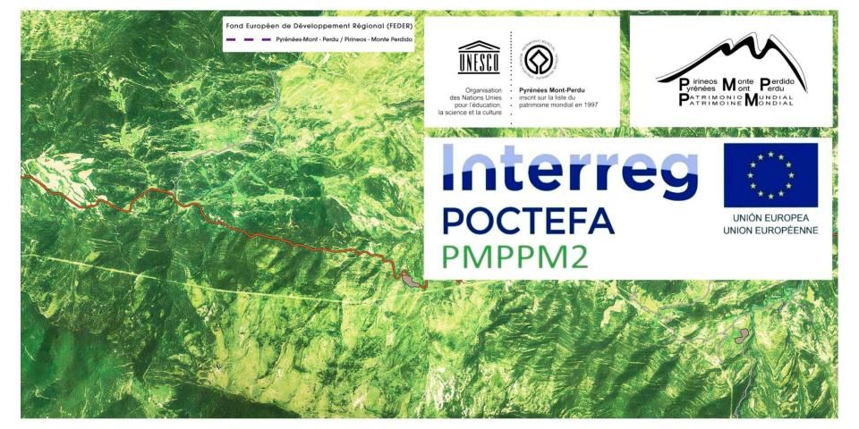
Ce projet est cofinancé par le Fonds Européen de développement Régional (FEDER).
Intererg - POCTEFA - PMPPMP2
Pyrénées - Mont Perdu - Patrimoine Mondial
Pirineos - Monte Perdido - Patrimonio Mundial
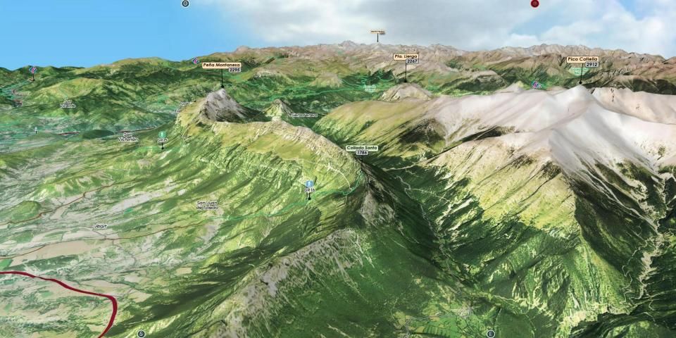
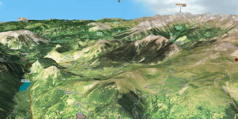
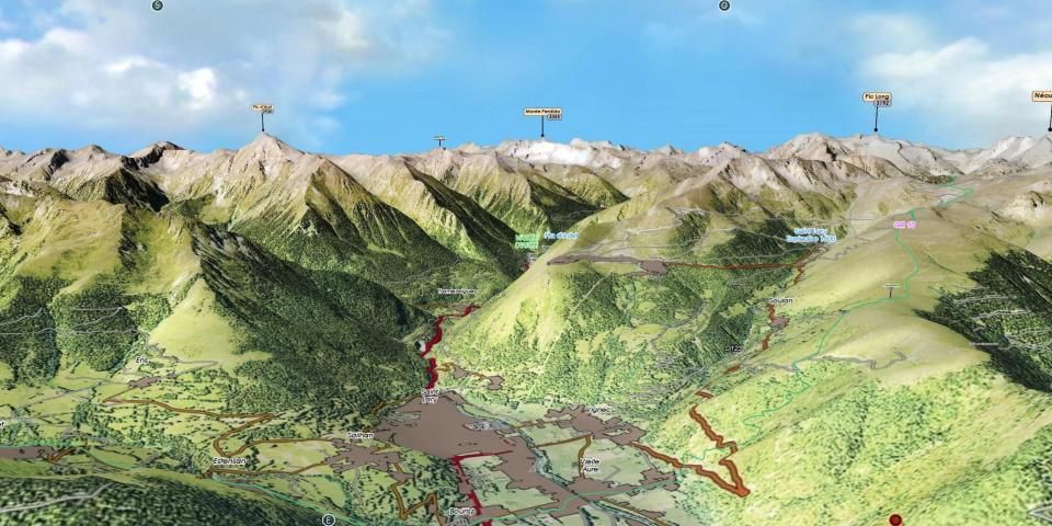
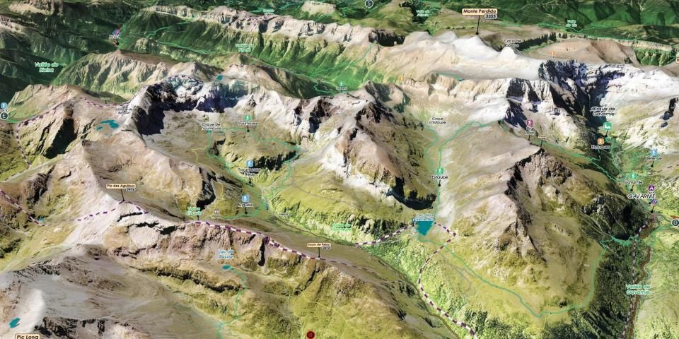
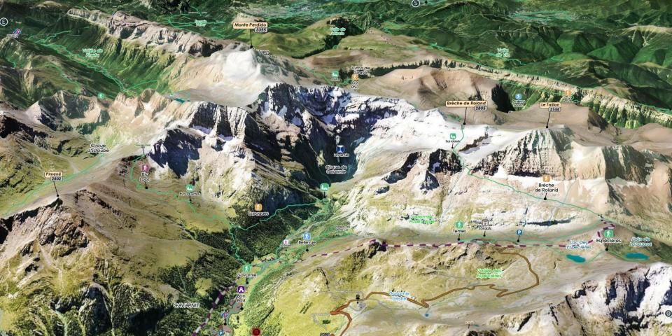
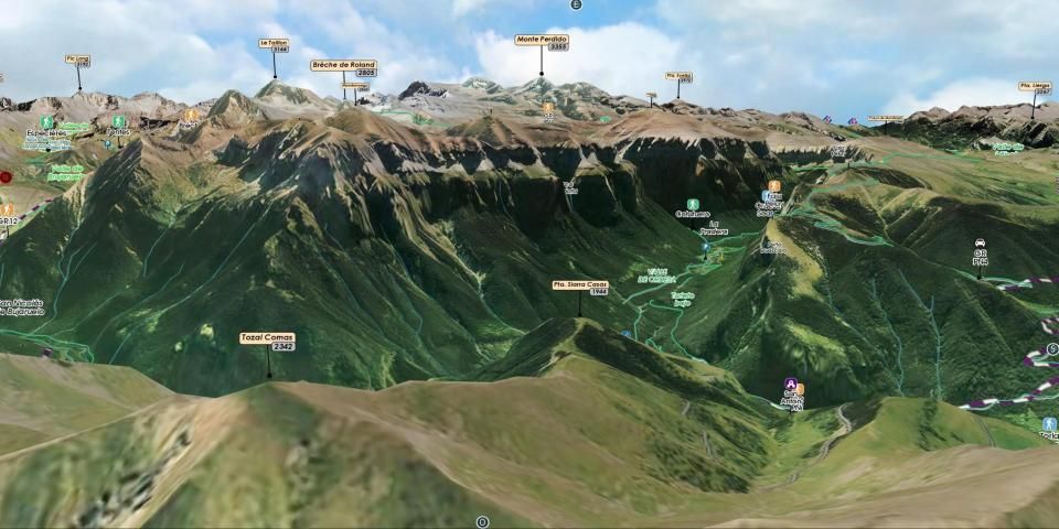
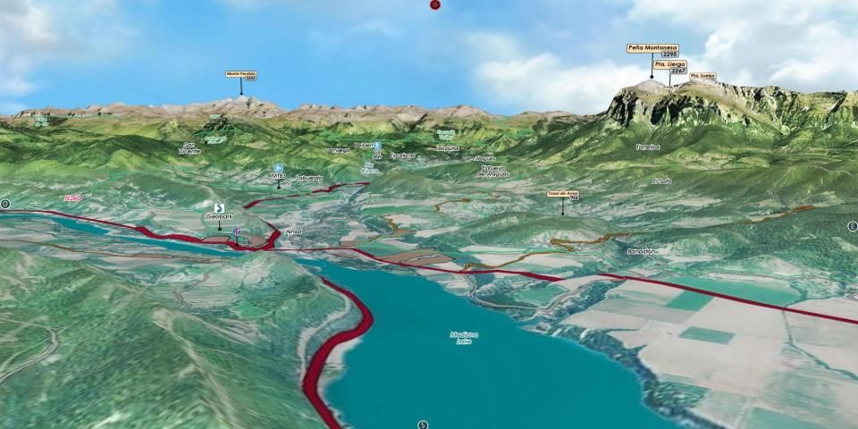
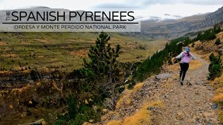
Cette application, en 3D immersive, permet de découvrir les richesses du territoire Patrimoine Mondial Pyrénées Mont Perdu - Pirineos Monte Perdido.
Retrouvez les descriptifs géologiques du Geoparque, les itinéraires de Sobrarbe et Gavarnie-Gèdre en voiture, VTT ou à pied.
Ce guide de randonnée embarqué et sa carte interactive, très simples à utiliser, sont accessibles hors ligne.
Bon séjour et bonne visite à tous.
FONCTIONS IMMERSIVES 3D
○ Commandes intuitives et précises... du bout des doigts.
○ Vue aérienne, survol
○ Vue et déplacement au sol
○ Boussole
○ Géolocalisation
GUIDE & DESCRIPTIFS
○ Descriptifs précis, texte et visuels
○ Affichage direct dans la 3D
GPS
Le GPS de votre téléphone est utilisé pour la géolocalisation sur la zone cartographiée, il est particulièrement utile pour voir sa position dans le relief, surtout en cas de mauvaise visibilité sur le terrain.
BOUSSOLE
Le mode boussole est intégré dans la 3D, les points cardinaux s’orientent selon les mouvements manuels ou la carte s’oriente automatiquement au Nord en activant le mode boussole directement depuis la 3D.
RELIEF & VUE AU SOL 3D
La vue aérienne et la vue au sol illustrent le relief général à un niveau de précision optimisé, elle s’affiche à l’écran en fonction de la définition du relief et de texture choisis au lancement de l’application, chargées automatiquement ou à sélectionner selon les capacités de l’appareil utilisé.
Le déplacement de la caméra au sol permet d’apprécier les détails de l’itinéraire à suivre et totale immersion dans le relief.
Application Interactive 3D Guide de randonnée - Face au Sud ® TOPOMAP3D ® www.faceausud.com
Marque et Modèles déposés 486299 08082013 - 12 3 953 606 © Tous droits réservés - Reproduction interdite.
Avec l'aimable participation de Helge Foerster jPCT 3D engine ® www.jpct.net Copyright © 2010
This project is co-financed by the European Regional Development Fund (ERDF).
Intererg - POCTEFA - PMPPMP2
Pyrenees - Mont Perdu - World Heritage
Pirineos - Monte Perdido - Patrimonio Mundial
This application, immersive 3D, allows to discover the wealth of the territory World Heritage Pyrenees Mount Perdu - Pirineos Monte Perdido.
Find geological descriptions of the Geoparque, the routes of Sobrarbe and Gavarnie-Gèdre by car, mountain bike or on foot.
This on-board hiking guide and its interactive map, very easy to use, are accessible offline.
Have a nice stay and have a good visit.
3D IMMERSIVE FUNCTIONS
○ Intuitive and precise controls ... with your fingertips.
○ Aerial view, overflight
○ View and movement on the ground
○ Compass
○ Geolocation
GUIDE & DESCRIPTIVE
○ Precise, textual and visual descriptions
○ Direct display in 3D
GPS
The GPS of your phone is used for geolocation on the mapped area, it is particularly useful to see its position in the terrain, especially in case of poor visibility in the field.
COMPASS
The compass mode is integrated in the 3D, the cardinal points are oriented according to the manual movements or the card is automatically oriented to the North by activating the compass mode directly since the 3D.
RELIEF & 3D GROUND VIEW
The aerial view and the ground view illustrate the general relief at an optimized level of precision, it is displayed on the screen according to the definition of relief and texture chosen at launch of the application, automatically loaded or select depending on the capabilities of the device used.
The movement of the camera on the ground makes it possible to appreciate the details of the route to be followed and total immersion in the relief.
Interactive 3D Application Trekking Guide - South Facing ® TOPOMAP3D ® www.faceausud.com
Trademark and registered design 486299 08082013 - 12 3 953 606 © All rights reserved - Reproduction prohibited.
With the kind participation of Helge Foerster jPCT 3D engine ® www.jpct.net Copyright © 2010
Première version.


9Apps 4.9


