
Erste afrikanische arabische ägyptische GIS GPS-Software von Africa Arab Egypt GIS Company elshayal Smart Gis
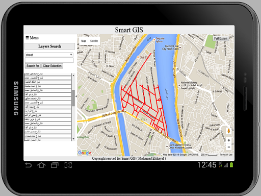
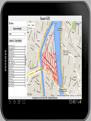
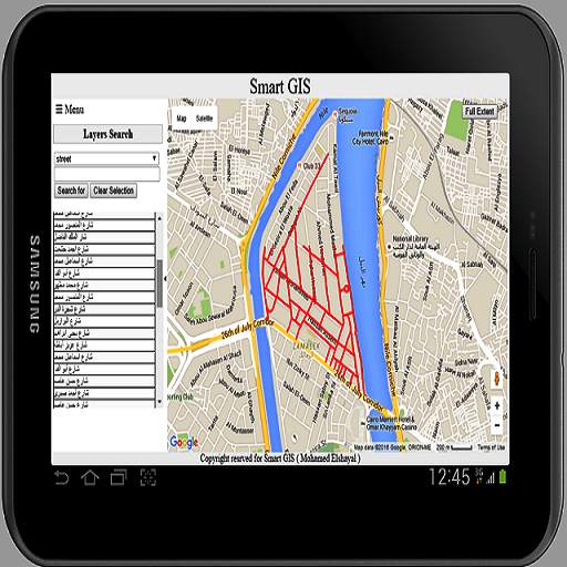
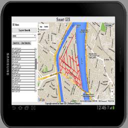
Elshayal Smart Gis ist die erste afrikanische arabische ägyptische GIS-GPS-Software, die von Afrika Arab Egypt GIS-Programmierer vollständig entwickelt ist und unabhängig von jedem kommerziellen Paket unabhängig von einem kommerziellen Paket entwickelt wird.Es wird nicht von einer Organisation finanziert, und es besteht aus: 1) Karten-Editor und Analyse für Desktop, 2) Kartenserver für das Web, 3) Mobile GPS-Tracking und Datenkollektor für Mobile, 4) herunterladen Richtige Google Earth, 5) offenSource, um GIS-Formdateien in HTML-Google Map Web GIS und Mobile App zu konvertieren.Hergestellt in Ägypten
Kostenloser Download von https://drive.google.com/file/d/0b2qr4wxkke_vumr6v2hyrhrqb2c/view?usp=Sharing
"Diese App sammelt Standortdaten, um [Tracking], & [Infrastrukturen) zu aktivierenAnsicht] Auch wenn die App geschlossen oder nicht verwendet wird. "


9Apps 4.9