Make instant geotagged and orientated pictures and view them at Google Earth.
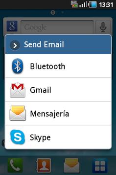
Kaml makes a geotagged picture, which can be sent by e-mail and visualized with Google Earth, at the same location and view orientation where the picture was taken. Kaml generates and sends two files, a .JPG one with the picture and a .KML one with the geographic coordinates and view angles.
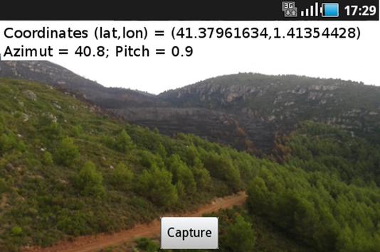
The geographic coordinates are obtained from the GPS, so that before open Kaml you must activate the GPS. Once the coordinates appear on the screen you are ready to take the geotagged picture. The two generated files (.JPG and .KML) are stored at the picture's folder of the SD card (e.g. /Pictures/KmlCam).
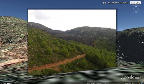
Once you download the two files in a PC you just need to open the .KML one with Google Earth, and you “fly” to the picture location and you see the shot you took overlapped with the 3D Google image terrain.
Kaml is perfect for your trips and hikes, or even to report to emergency services information about natural disasters such as forest fires, flooding or humanitarian crises.


9Apps 4.9