This is a steampunk themed GPS navigation app.
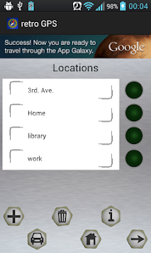
Add locations with the button, select locations touching them on the list, the green bulb will show which location is selected.
To navigate to the selected location, press the arrow button, the car and home buttons will select its location and begin the navigation.
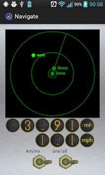
In the navigation screen you see a "radar" screen where the destination appears in light green, your current location is at the center of the circles, the position of your target destination in the screen depends on your distance to it and the bearing of the location in reference to your device's position.
Using the one/all switch you can opt to show the rest of the saved locations which are in range.
Using the km/mi switch the distance and speed are shown in metric or imperial units.
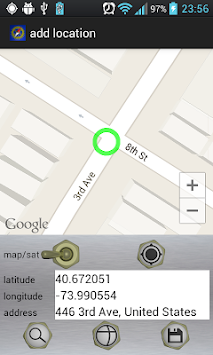
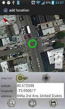
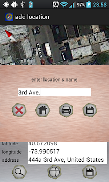
To pick a location you can use either the map, the longitude and latitude or enter an address. press the save button to save the location displayed.
The search button will try to locate the address.
The coordinates button will center the map on the entered latitude and longitude.
The GPS button will center the map on your current position if you have GPS signal.
Use the switch to change between map and satellite views.
Keep in mind that all GPS locations can have errors bigger than 10 meters.
Also, DO NOT handle your device while driving, safety first!
Hope you like it!
Uses internet permission to show maps, look up addresses and show ads.
Uses location access permission to get the GPS signal.
Uses storage permission to save the location's database.


9Apps 4.9