

Free and secured download of Android apps on 9Apps. 30,000+ users downloaded Village Map latest version on 9Apps for free every week! The app has made a strong effect. This hot app was released on 2020-04-03. You’ll want to use it on your own phones after you know more.
Village Maps - Village Satellite Map
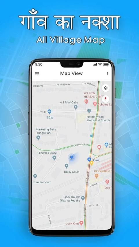
This All Village Maps is very helpful for tourists and also all locals to get full overview of different villages and their local spots, shops, businesses and all attractive places in detail.
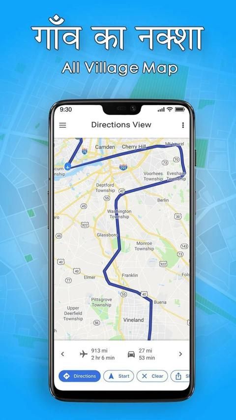
This Village Map app gives you a full overview of what happens in your village and the surrounding rural areas.
Village map live street it is possible for tourists and locals to get a full overview over the different villages and their local spots, attractions, shops and businesses in general.
Free application to heck the bhulekh and khasara & see the village tour with free map.
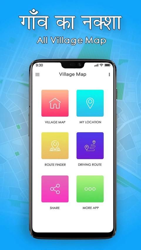
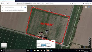
This map of india with bhulekh and land records make this app convenient. Indian village maps allows to save to my village. See state wise, districts of India, sub district and village data.
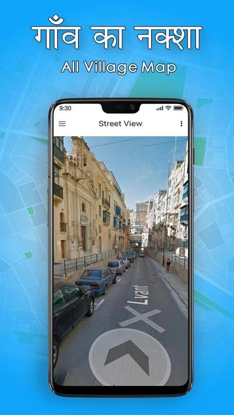
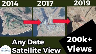
This Satellite View maps give details view of major roads & street. Requires GPS & Internet to be enabled at start. With minimum 3 minutes interval if location is changed.
All Village Map With District of India gives information about your village's location too. You can save your Village map live street as my village too.
This application helps tourists and locals to get the information & map location of different villages and their local spots, attractions, shops and businesses in general.
Thanks !!!!!!!!!!!!!!!!!!!!!!!!!!!!!
ग्राम मानचित्र - ग्राम उपग्रह मानचित्र
यह ऑल विलेज मैप्स पर्यटकों और सभी स्थानीय लोगों के लिए विभिन्न गांवों और उनके स्थानीय स्थानों, दुकानों, व्यवसायों और विस्तार से सभी आकर्षक स्थानों का पूरा अवलोकन प्राप्त करने के लिए बहुत मददगार है।
यह विलेज मैप ऐप आपको आपके गाँव और आसपास के ग्रामीण क्षेत्रों में क्या होता है, का पूरा अवलोकन देता है।
गांव का नक्शा लाइव स्ट्रीट पर्यटकों और स्थानीय लोगों के लिए विभिन्न गांवों और उनके स्थानीय स्थानों, आकर्षणों, दुकानों और व्यवसायों के बारे में पूरी जानकारी प्राप्त करना संभव है।
मुफ्त आवेदन भेलख और खसरा को और मुक्त नक्शे के साथ गांव के दौरे को देखने के लिए।
भलख और भूमि रिकॉर्ड के साथ भारत का यह मानचित्र इस ऐप को सुविधाजनक बनाता है। भारतीय गाँव के नक्शे मेरे गाँव को बचाने की अनुमति देते हैं। राज्यवार, भारत के जिले, उप जिला और ग्राम डेटा देखें।
यह सैटेलाइट व्यू मैप प्रमुख सड़कों और सड़कों का विवरण देता है। प्रारंभ में सक्षम होने के लिए GPS और इंटरनेट की आवश्यकता होती है। स्थान बदलने पर न्यूनतम 3 मिनट के अंतराल के साथ।
भारत के जिला के साथ सभी गाँव का नक्शा आपके गाँव के स्थान के बारे में भी जानकारी देता है। आप मेरे गाँव के रूप में अपने गाँव के नक्शे को लाइव स्ट्रीट भी बचा सकते हैं।
यह एप्लिकेशन पर्यटकों और स्थानीय लोगों को विभिन्न गांवों और उनके स्थानीय स्थानों, आकर्षण, दुकानों और व्यवसायों की जानकारी और मानचित्र स्थान प्राप्त करने में मदद करता है।
धन्यवाद !!!!!!!!!!!!!!!!!!!!!!!!!!!!!
Village Maps - Village Satellite Map


9Apps 4.9