Still today the influence of mining can be noticed here and in the whole tradition-rich landscape of the central Ore Mountains as well. In the scope of transnational projects named Ziel 3 (target 3) some outstanding objects out of the variety of witness of mining history got connected with two educational trails and were equipped with information boards, in corporation with the local miners associations Pobershauer Bergbruederschaft e.V. and Bergknappschaft Marienberg e.V.
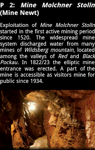
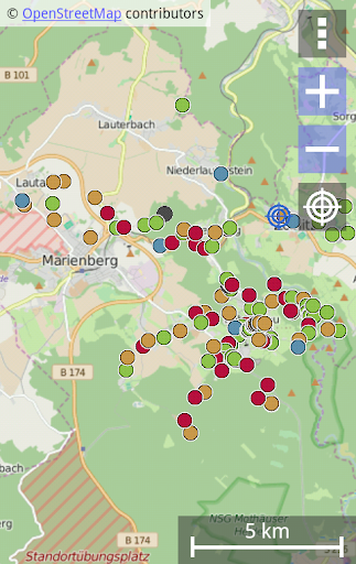
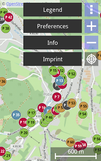
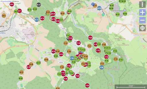
To support the hiker on his search for traces, this app lists all 139 german POIs around Zoeblitz, Rittersberg, Huettengrund, Gebirge, Gelobtland, Niederlauterstein and Lauta, with the help of a map. In addition to the exact locations of the information boards, the user gets a short historic extract that is enriched with some fotos.
Now its your turn as hiker to explore the traces of mining. The remnants of mining wait partially hidden and forgotten by time at the wayside for their discovery.
"Glueck auf!"
POI information is available in English partially only (P1 to P35).
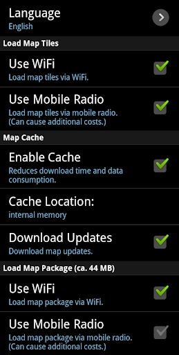
To download the map, an active data connection is neccessary. This can cause additional costs. To use the map offline, the map package (about 59 MB) will be downloaded automatically on app startup (see preferences).
Descriptions were missing in some cases.
9Apps 4.9